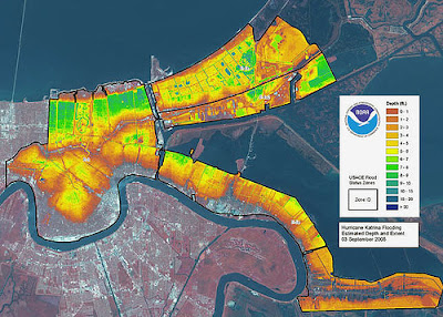
http://flickriver.com/photos/gisuser/tags/letham/ A LIDAR Map is a high-resolution digital elevation map that is enhanced with color to show the variation among elevations. This is a LIDAR map of New Orleans after hurricane Katrina to show the elevation of the flooding.
No comments:
Post a Comment